A covered bridge trail takes about 4 hours to drive on average in 2026, ranging from under 90 minutes for a short 5-bridge loop to a full 7 to 8 hour day for a 30-plus bridge trail like Parke County, Indiana. That figure covers driving time only — stopping to walk onto each bridge, take photos, or grab lunch in a small town easily doubles it.
- A covered bridge trail takes about 4 hours to drive on average in 2026, from 90 minutes for short loops to 7-8 hours for 30+ bridge trails.
- Parke County, Indiana runs a full-day driving loop across 31 covered bridges.
- Ashtabula County, Ohio fits into a half-day at 19 covered bridges.
- Walking onto bridges and stopping for photos roughly doubles straight drive time.
- A covered bridge checklist tracker helps split a 30+ bridge trail across two days without doubling back.
Why this matters
Covered bridge trails don't follow a straight Google Maps estimate. The bridges sit on county roads that curve around rivers and ravines, so ten miles on the map can eat twenty minutes of actual driving time. Skip the planning and you either blow past half the bridges on your list or burn a full vacation day on a loop you expected to finish before lunch.
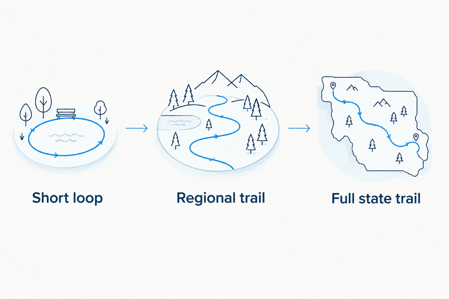
Triptyka's printable bucket-list checklists are built for exactly this kind of trip math — collectors use them to log which bridges, ballparks, or lighthouses they've already hit and how many stops are left on a route. Knowing which tier of trail you're driving — short loop, regional trail, or full state circuit — tells you more about the day ahead than the mile count on your GPS ever will. That distinction matters more the farther you get from home, since a wrong guess on drive time in rural Ohio or Indiana means finishing the last few bridges in the dark.
How long does a covered bridge trail take to drive?
Drive time on a covered bridge trail scales directly with how many bridges are strung along the route and how spread out they are across the county. Here's the breakdown by trail size, based on drive time with and without stops, in 2026:
| Trail size | Bridges | Drive time (no stops) | Drive time (with stops) |
|---|---|---|---|
| Short county loop | 5-10 | 1-2 hours | 2-4 hours |
| Regional trail | 15-20 | 3-5 hours | Half a day |
| Full county/state trail | 30+ | 6-8 hours | Full day |
The "no stops" column assumes you drive past every bridge without parking. Almost nobody actually does this — the whole point of a covered bridge trail is pulling over to walk onto the wooden deck and hear it creak.
Short covered bridge loop (5-10 bridges): under 2 hours
A short loop covering 5 to 10 covered bridges in one county or one river valley takes under 2 hours to drive straight through, and most fit into a half-day trip with lunch on either end. These loops work well as a weekend add-on rather than a dedicated trip, especially if you're already driving through a covered bridge county for another reason. Verdict: good for a casual afternoon, skip it if you're chasing a full state list.
Regional covered bridge trail (15-20 bridges): half a day (3-5 hours)
A regional trail with 15 to 20 bridges, close to the scale of Ashtabula County, Ohio's 19-bridge network, runs 3 to 5 hours of straight driving and closer to half a day once you stop at even half the bridges. Ashtabula County has more covered bridges than any other county east of the Mississippi, and its bridges sit spread across a large rural county, so the miles between stops add up fast even though the bridge count looks manageable on paper. Verdict: the sweet spot for a single day trip with room to actually get out of the car.
Full county or state covered bridge trail (30+ bridges): a full day (6-8 hours)
A full trail with 30 or more bridges, the scale of Parke County, Indiana's 31-bridge network — known as the Covered Bridge Capital of the World — runs 6 to 8 hours of driving alone, and most visitors split it across two days if they want to walk onto more than a handful of bridges. The bridges here are scattered across the whole county rather than clustered along one river, which is why the drive time jumps so much between the regional tier and this one. Verdict: plan an overnight if you want to see all 31 without rushing.
Why covered bridge trail time varies
- Number of bridges on the route — more stops means more time, even on good roads.
- Distance between bridges — clustered bridges in one river valley drive faster than bridges scattered across a whole county.
- Whether you stop and walk each bridge — driving past adds minutes, parking and walking onto each one adds hours.
- Road surface — some covered bridge roads are still gravel or dirt township roads, slower after rain and rough after heavy snow.
- Season — fall foliage weekends bring the heaviest traffic to popular bridge counties.
- Photo and lunch stops — small towns along these routes rarely have fast food nearby, so meal stops run longer than they would on a highway trip.
What to bring on a covered bridge driving trail
Cell service drops out on the back roads that most covered bridges sit on, so a paper map or an offline map download matters more here than on a highway trip. Comfortable shoes help too — bridge decks are wood, sometimes uneven, and you'll be in and out of the car dozens of times on a full county trail.
A simple rule keeps the day on schedule: if the trail is going to take longer than a tank of gas to finish, split it across two days instead of rushing the back half in the dark.
“If a covered bridge trail takes longer than a tank of gas to finish, split it across two days instead of rushing the back half in the dark.”
Pairing a covered bridge trail with a bigger road trip
Covered bridge trails rarely stand alone on a road trip itinerary — they usually get folded into a longer scenic drive through the same rural counties. If you're stacking one onto a bigger route, check how long it takes to drive all of America's scenic byways before you commit to a multi-day plan, since byway mileage adds up faster than bridge-to-bridge driving does.
Tracking your covered bridge visits
Once you've picked a tier — short loop, regional trail, or full state circuit — the next problem is remembering which bridges you've actually crossed off. The covered bridge checklist trackers roundup covers printable options built for exactly that: logging each bridge by name and county so a two-day Parke County trip doesn't turn into backtracking for bridges you already passed.
A printed tracker also works better than a phone app on these routes, given how often cell service disappears once you're a few miles off the main highway.
Related questions
How many covered bridges are there in the US?
More than 700 historic covered bridges still stand in the US as of recent counts, concentrated in Pennsylvania, Ohio, Indiana, and Vermont. That's down from an estimated 10,000-plus in the mid-1800s, before steel and concrete became the default bridge material.
Is Parke County, Indiana, or Ashtabula County, Ohio, better for a bridge road trip?
Parke County, Indiana wins for completionists with 31 bridges and a full-day driving loop in 2026, while Ashtabula County, Ohio fits better into a single day with 19 bridges and a half-day drive. Pick Parke County if you have a full day or an overnight, Ashtabula if you only have an afternoon to spare.
Do covered bridge trails close in winter?
Most covered bridge trails stay open year-round since the bridges sit on public roads, but the gravel township roads common in Ohio and Indiana get slow or impassable after snow and heavy rain. Spring through fall is the easier driving season for these routes, and it's also when small-town cafes along the way are more likely to be open.
FAQ
How long does a covered bridge trail take to drive?
A covered bridge trail takes about 4 hours to drive on average in 2026, ranging from under 90 minutes for a short 5-bridge loop to 7-8 hours for a 30-plus bridge trail. Walking onto each bridge and stopping for photos roughly doubles that time.
How many covered bridges does Parke County, Indiana, have?
Parke County, Indiana has 31 historic covered bridges, more than any other county in the US, which is why it's known as the Covered Bridge Capital of the World. The full loop runs 6 to 8 hours of driving.
How many covered bridges does Ashtabula County, Ohio, have?
Ashtabula County, Ohio has 19 covered bridges, the most of any county east of the Mississippi. The driving loop runs 3 to 5 hours without stops, closer to half a day with them.
Do you need to walk onto each covered bridge, or can you just drive by?
Most covered bridges are drivable, so you can pass through without stopping, but pulling over to walk onto the deck is the reason most people plan these trails. Walking each bridge roughly doubles straight-driving time.
What's the best season to drive a covered bridge trail?
Fall is the most popular season for covered bridge trails because of foliage, but spring through fall in general is easier driving than winter. Gravel township roads common on these routes can get slow or closed after snow.
Is a covered bridge trail a good day trip or does it need an overnight?
Short loops of 5 to 10 bridges fit easily into a single day, but full county trails with 30-plus bridges, like Parke County's, often split across two days for anyone stopping at most of them. A tank-of-gas rule of thumb works well for deciding when to split it.
Can I keep track of which covered bridges I've visited?
A printable checklist tracker lets you log each bridge by name and county as you cross it off, which matters most on trails with 19 or more stops. Paper trackers also hold up better than phone apps on routes where cell service disappears.
One last thing
There were once more than 10,000 covered bridges in the US; fewer than 700 survive today, and most of the counties that still have a dozen or more turned that scarcity into a driving trail on purpose. The trail you're mapping a route around exists largely because a handful of rural counties in Ohio, Indiana, Pennsylvania, and Vermont decided their leftover wooden bridges were worth preserving instead of tearing down for steel replacements — which is also why so many of them still sit on slow, unmarked township roads in 2026 instead of state highways.